Top Drone Photographers Mombasa for Coastal Properties
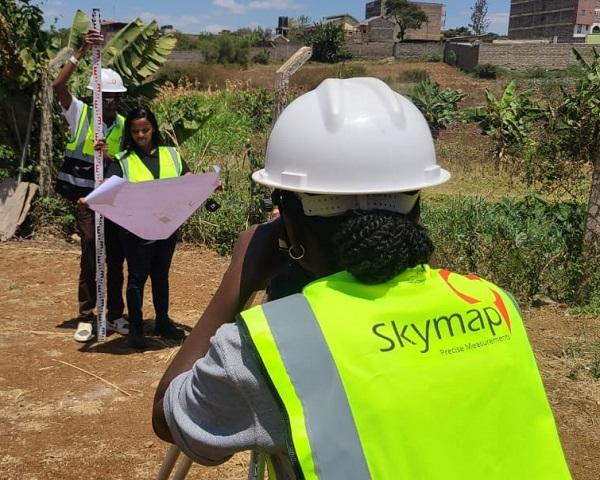
Specialised drone photographers in Mombasa provide high-resolution aerial marketing assets that real estate agencies and coastal developers use to showcase waterfront properties. Professional real estate photography Kenya depends on certified aerial operators to ensure regulatory compliance and technical proficiency when managing the high-contrast lighting of the Indian Ocean coastline.
- SkyLens Mombasa Aerial Solutions
- Coastline Visions Drone Photography
- Mombasa AeroPix Property Specialists
- Horizon Aerials Kenya Drone Services
- Pwani Property Drone Imaging
- Shanzu SkyView Drone Photography
- Diani Aerial Capture Solutions
| Service Category | Equipment Used | Primary Deliverables | Turnaround Time |
|---|---|---|---|
| Standard Residential | DJI Mavic 3 Pro / Mini 4 Pro | 15 High-Res Stills, 1 Min Video | 48 Hours |
| Commercial Development | DJI Inspire 3 / Autel EVO II | 30 Stills, 3 Min Promo, RAW Files | 72 Hours |
| Enterprise Mapping | Matrice 300 RTK | Orthomosaic Maps, 3D Models | 5 Days |
1. SkyLens Aerial Solutions for Mombasa Properties
Technical Drone Equipment for Coastal Photography
SkyLens technicians operate DJI Mavic 3 Pro platforms equipped with Hasselblad optics to ensure maximum dynamic range during high-contrast coastal shoots. Coastal aerial photography must account for polarisation management to cut through the heavy glare of the Indian Ocean. Deploying a circular polarising filter is mandatory to reveal the turquoise clarity of the water and the white sand of Diani or Nyali without the sun reflecting harshly off the waves. This approach ensures a professional Mombasa photographer produces clean, usable assets for luxury listings.
Portfolio Highlights for Beachfront Property Developers
Property developers utilise SkyLens to map expansive beach-front plots and document the exact distance between residential units and the high-water mark. Their portfolio features extensive work in Nyali and Shanzu, highlighting architectural symmetry and surrounding coastal vegetation. Presenting properties from a 45-degree aerial angle provides potential buyers with an accurate understanding of lot dimensions and neighbourhood density.
Service Packages for Mombasa Aerial Content
Real estate marketers select from structured tiers designed for specific property sizes. SkyLens bases its rates on flight time, required permits, and post-production complexity.
| Package Tier | Inclusions | Turnaround Time |
|---|---|---|
| Single Plot Standard | 15 Photos, 1 Minute Video | 48 Hours |
| Estate Premium | 30 Photos, 3 Minute Video, Graphics | 72 Hours |
| Developer Mapping | Orthomosaic Map, Raw Footage | 5 Days |
Customer Outcomes for Real Estate Projects
Kilifi-based property developers report a direct increase in off-plan sales after implementing SkyLens aerial tours into their pitch decks. International investors rely on these precise aerial perspectives to verify construction progress and site proximity to major infrastructure. Agency directors frequently commend the flight team for maintaining strict adherence to scheduled shooting windows during optimal morning light.
Vertical Video Production for Social Media Engagement
Content strategists require native vertical formats to populate Instagram Reels and TikTok feeds for property listings. SkyLens pilots execute specific flight paths tailored for the 9:16 aspect ratio, ensuring the primary subject remains centred during ascending or orbiting manoeuvres. Delivering pre-cut vertical assets allows agencies to bypass secondary editing and launch digital campaigns immediately.
2. Coastline Visions Aerial Imaging Specialists
Technical Drone Equipment for Coastal Photography
Coastline Visions deploys the DJI Inspire 3 system to handle the strong crosswinds frequently encountered over the Tudor and Mtwapa creeks. Pilots utilise interchangeable lenses to compress the background, making distant landmarks like Fort Jesus or the Mombasa port appear closer to the listed property. The team monitors wind shear metrics meticulously to ensure stable footage during high-altitude panoramic captures. High-end videography Kenya standards are maintained through the use of Prores codecs for maximum colour grading flexibility.
Portfolio Highlights for Beachfront Property Developers
Agencies marketing high-rise apartment blocks depend on Coastline Visions to document balcony views from specific floor heights before construction finishes. Their visual catalogue demonstrates a strong focus on structural elevations and integration with surrounding marine environments. Capturing infinity pools aligning perfectly with the ocean horizon remains a signature deliverable in their commercial portfolio.
Service Packages for Mombasa Aerial Content
Commercial clients secure Coastline Visions through project-based contracts rather than hourly rates. This model accommodates weather delays and complex airspace authorisation processes.
| Service Level | Target Property | Deliverables |
|---|---|---|
| Residential Basic | Single Family Villas | 10 Edited Images, Unedited Video |
| Commercial Pro | Apartment Blocks | 25 Images, Edited Promo, Floor Views |
| Resort Master | Hotels & Lodges | Full Day Shoot, All Raw Files, 5 Videos |
Customer Outcomes for Real Estate Projects
Mombasa hospitality brands frequently commission Coastline Visions to update their seasonal marketing collateral. Hotel managers state that the updated aerial videography directly improved their direct booking conversion rates by providing guests with realistic spatial expectations. Real estate brokers cite the team's professional conduct on-site as a key factor in securing repeat contracts.
Vertical Video Production for Social Media Engagement
Social media managers distribute Coastline Visions' vertical cuts across Facebook Ads to target diaspora buyers looking for coastal holiday homes. The editing team applies dynamic speed ramping to vertical clips, accelerating the transition between the property entrance and the oceanfront. This editing technique improves viewer retention in fast-paced social media environments.
3. Mombasa AeroPix Property Drone Specialists
Technical Drone Equipment for Coastal Photography
Mombasa AeroPix integrates First Person View (FPV) drones alongside traditional stabilised platforms to create immersive property tours. Pilots utilise the DJI Avata series with custom neutral density filters to maintain appropriate shutter speeds during bright midday shoots. Flying small-form-factor FPV units allows the team to transition smoothly from exterior aerial views directly into interior living spaces through open balcony doors.
Portfolio Highlights for Beachfront Property Developers
Luxury Airbnb operators across English Point hire AeroPix to differentiate their listings on crowded booking platforms. The AeroPix portfolio emphasises continuous one-shot property tours that connect the driveway, interior lounge, and rear beach access. Following these Airbnb photography tips for spatial continuity provides remote renters with confidence in the property layout.
Service Packages for Mombasa Aerial Content
AeroPix categorises its services based on the required flight complexity and the integration of interior FPV operations.
| Package Name | Flight Operations | Editing Scope |
|---|---|---|
| Exterior Only | Standard Orbit & Reveal | Basic Colour Correction |
| Hybrid Tour | Exterior + Interior FPV | Advanced Grading & Audio |
| Twilight Special | Golden Hour & Night Flights | Low-Light Noise Reduction |
Customer Outcomes for Real Estate Projects
Property managers in Nyali credit the FPV fly-through videos for reducing the volume of repetitive client inquiries regarding property layouts. Estate agents highlight the rapid delivery of finalised assets, which allows them to list newly acquired properties ahead of local competitors. Testimonials frequently mention the pilots' strict adherence to privacy boundaries when flying near neighbouring estates.
Vertical Video Production for Social Media Engagement
Digital marketers leverage AeroPix's vertical FPV dives to generate high engagement on property-focused YouTube Shorts. The post-production team reframes high-speed 4K horizontal footage into sharp vertical assets without losing critical architectural details. Adding bold textual callouts to these vertical videos ensures the property specifications register with viewers watching on mobile devices with muted audio.
4. Horizon Aerials Kenya Drone Services
Technical Drone Equipment for Coastal Photography
Horizon Aerials operators rely on the Matrice 300 RTK enterprise drone system to execute large-scale land mapping operations along the South Coast. Technical teams utilise Real-Time Kinematic modules to guarantee centimetre-level accuracy when demarcating boundary lines for large coastal agricultural plots. The weather-sealed equipment allows pilots to continue operations during sudden coastal drizzles or heavy sea spray environments.
Portfolio Highlights for Beachfront Property Developers
Investment consortiums evaluating multi-acre beachfront plots in Kwale County commission Horizon Aerials for comprehensive topographical surveys. Their portfolio prioritises orthomosaic maps and 3D terrain models over standard aesthetic videography. Presenting these geographical representations enables developers to plan drainage, access roads, and structural foundations before breaking ground.
Service Packages for Mombasa Aerial Content
Horizon Aerials prices its mapping and surveying services by acreage and the required data resolution. Many clients hire them for commercial photography Kenya projects requiring detailed site analysis.
| Service Matrix | Coverage Area | Data Output |
|---|---|---|
| Micro Survey | Up to 5 Acres | 2D Orthomosaic, Boundary Lines |
| Macro Development | 5 - 50 Acres | 3D Modelling, Topography Map |
| Retainer Updates | Variable | Monthly Progress Scans |
Customer Outcomes for Real Estate Projects
Civil engineering firms rely on Horizon Aerials' preliminary data to secure environmental impact approvals for coastal construction projects. Land buyers state that the precise aerial boundary overlays prevented purchasing disputes with neighbouring landowners. The operations team receives consistent praise for their detailed pre-flight safety briefings and transparent risk assessments.
Vertical Video Production for Social Media Engagement
Horizon Aerials provides real estate firms with vertical highlight reels of large land tracts. Marketers use these aerial sweeps on WhatsApp Business catalogues to demonstrate the proximity of raw land to main highways or utility lines. Compressing large aerial perspectives into digestible mobile formats accelerates the initial buyer qualification process.
5. Pwani Property Drone Imaging
Technical Drone Equipment for Coastal Photography
Pwani Property Imaging teams deploy DJI Air 2S units chosen for their balance of high-resolution output and rapid deployment capabilities. Pilots apply specific colour profiles during flight to capture the distinct red coastal soils contrasting with the green palm canopies. Utilising intelligent flight modes ensures perfectly smooth orbital shots around residential pillars or standalone gazebos.
Portfolio Highlights for Beachfront Property Developers
Gated community developers in Vipingo utilise Pwani Imaging to track the construction phases of residential units. The company's visual gallery showcases consistent, repeatable flight paths executed monthly to document structural progress from foundation pouring to roof installation. Showcasing the completed amenities alongside the oceanfront establishes the lifestyle value of the development.
Service Packages for Mombasa Aerial Content
Pwani Property Imaging structures its rates to accommodate agents requiring high-volume shoots across multiple listings in a single day. Their book photographer interface allows for quick scheduling of these multi-site sessions.
| Service Option | Properties Covered | Included Revisions |
|---|---|---|
| Single Listing | 1 Property | 1 Round |
| Agent Day Rate | Up to 4 Properties | 2 Rounds |
| Construction Tracker | 1 Site (6 Months) | Monthly Updates |
Customer Outcomes for Real Estate Projects
Independent real estate agents commend Pwani Imaging for their efficient on-site workflow, which minimises disruption to existing tenants. Property syndicates report that the consistent quality of the monthly construction updates builds trust with their diaspora investors. Clients note the prompt communication and transparent invoicing procedures maintained by the administrative team.
Vertical Video Production for Social Media Engagement
Social media agencies contract Pwani to provide raw vertical clips which they incorporate into broader lifestyle marketing campaigns. The flight team frames aerial shots specifically to leave negative space at the top and bottom of the frame for promotional text and agency logos. Providing clean, unbranded vertical assets gives real estate firms control over their final social media branding.
6. Shanzu SkyView Drone Photography
Technical Drone Equipment for Coastal Photography
Shanzu SkyView relies on the Autel Robotics EVO II Pro to capture pristine 6K video across high-density residential zones. The 1-inch sensor processes extreme variations in lighting, which is essential when shooting properties half-covered in deep shadow from neighbouring high-rises. Pilots utilise the drone's omnidirectional obstacle avoidance to navigate safely between tight building corridors and complex roof structures.
Portfolio Highlights for Beachfront Property Developers
Boutique hotel owners on the North Coast leverage SkyView's media to showcase rooftop amenities and private beach access points. The portfolio heavily features sunset transitions, demonstrating the property's lighting aesthetics as natural daylight fades. Capturing the exact moment exterior property lights illuminate against the darkening ocean background forms the core of their visual offering.
Service Packages for Mombasa Aerial Content
SkyView provides tailored media bundles focused on enhancing digital listings and website header backgrounds. They work closely with Photoshoot Kenya to provide comprehensive visual coverage for hospitality brands.
| Media Bundle | Best Suited For | Deliverable Format |
|---|---|---|
| Digital Listing | Standard Rentals | Web-Optimised JPEGs |
| Website Header | Luxury Hotels | 4K Looping Video |
| Print Campaign | Sales Brochures | Full Resolution RAW |
Customer Outcomes for Real Estate Projects
Marketing directors for high-end resorts report a significant upgrade in their website aesthetics after integrating SkyView's 6K looping video headers. Local property management firms state that high-resolution roof inspections provided alongside the marketing media saved them substantial maintenance costs. Reviewers consistently highlight the editing team's ability to digitally remove temporary construction debris from the final images.
Vertical Video Production for Social Media Engagement
Content creators format SkyView's 6K footage into multiple vertical clips without sacrificing pixel density or sharpness. Marketing teams distribute these high-quality vertical snippets across Instagram Stories to create urgency for weekend open house events. The superior resolution allows editors to digitally pan across the vertical frame, creating movement even from static hovering shots.
7. Diani Aerial Capture Solutions
Technical Drone Equipment for Coastal Photography
Diani Aerial operators fly the DJI Mini 4 Pro for low-impact shoots over private residential zones in Kwale County. The sub-250-gram weight classification allows a Diani photographer greater operational flexibility in populated beachfront areas while still delivering 4K HDR video. The technical team calibrates the gimbal settings strictly to ensure smooth tilt movements during vertical reveals of large estate properties.
Portfolio Highlights for Beachfront Property Developers
Holiday rental managers rely on Diani Aerial to highlight the isolation and privacy of luxury villas tucked within coastal forests. Their imagery focuses heavily on the contrast between manicured compound lawns, private pools, and the wild coastal flora. The portfolio proves effective at establishing the exact walking distance from the villa gates to the primary white sand beaches.
Service Packages for Mombasa Aerial Content
Diani Aerial Capture structures its pricing to appeal directly to individual homeowners and boutique property managers on the South Coast.
| Service Package | Ideal Client | Media Volume |
|---|---|---|
| Homeowner Basic | Private Sellers | 12 Aerial Stills |
| Villa Premium | Holiday Rentals | 20 Stills, 2 Min Promo |
| Agent Retainer | Local Brokers | Volume Based Custom |
Customer Outcomes for Real Estate Projects
South Coast expatriates selling holiday homes frequently secure buyers faster by presenting Diani Aerial's comprehensive visual packages. Villa managers report improved guest satisfaction scores because the aerial footage perfectly sets expectations regarding the property layout and beach access. Clients appreciate the team's ability to execute complex shot lists within tight two-hour morning windows before the coastal heat haze sets in.
Vertical Video Production for Social Media Engagement
The editing team at Diani Aerial specialises in crafting 15-second vertical teaser videos designed specifically for mobile algorithms. Pilots shoot these sequences using vertical camera orientation to maximise sensor usage and eliminate post-production cropping. Delivering native vertical video ensures property lines, swimming pools, and architectural features remain perfectly sharp on high-resolution mobile displays.
KCAA Regulatory Compliance for Mombasa Drone Operations
Commercial drone operations in Kenya fall under the jurisdiction of the Kenya Civil Aviation Authority (KCAA). Property developers must ensure their chosen drone photographer holds a valid Remote Pilot Licence and operates under a certified Unmanned Aircraft System Operator Certificate. Failing to verify these credentials exposes the property owner to legal liabilities and potential project shutdowns by local authorities.
Operating near coastal aviation hubs requires specific flight permissions and airspace coordination. Drone pilots must secure KCAA authorisation when shooting properties near Moi International Airport or the Vipingo Ridge airstrip to prevent interference with low-flying manned aircraft. Professional operators manage this entire regulatory workflow, submitting flight plans and paying the necessary permit fees on behalf of the real estate client.
Standard Deliverables for High End Coastal Marketing
High Resolution Aerial Photography and Videography
Real estate agencies require 48-megapixel RAW image files to extract maximum detail for large format print brochures and roadside billboards. Operators record aerial video in 10-bit D-Log colour profiles, providing post-production teams with the necessary data to balance the bright sky against shaded ground features. Finalising these files in standard formats ensures immediate compatibility with major property listing websites like BuyRentKenya or Property24.
Vertical 4K Drone Videos for Social Media Engagement
Digital marketers demand 4K vertical formats to maintain visual fidelity across highly compressed platforms like Instagram and TikTok. Providing natively shot vertical video prevents the soft edges and pixelation associated with aggressively cropping horizontal footage. These mobile-optimised deliverables drive higher engagement metrics, as they occupy the entire smartphone screen during the user's scrolling session.
Advanced Post Production and Editing Workflows
Editing teams apply 3D motion tracking graphics to aerial footage to clearly outline property boundaries and highlight nearby amenities. Post-production editors utilise advanced software to remove distracting elements like temporary scaffolding or power lines from the final images. Integrating professional colour grading ensures the Indian Ocean appears accurately vibrant, matching the client's commercial marketing standards.
Booking Procedures for Professional Drone Services
Property managers initiate bookings by submitting a detailed project brief outlining the property location, size, and required deliverables. Drone operators evaluate the site coordinates to determine airspace restrictions and generate an accurate quotation covering equipment, flight time, and permit fees. Securing the shoot date requires a standard 50% deposit, which locks in the pilot's availability and funds the initial KCAA permit applications.
Clients coordinate closely with the flight team to establish weather contingencies, as coastal monsoons or heavy winds will ground drone operations. Establishing a clear timeline for the primary shoot and potential fallback dates ensures the marketing campaign remains on schedule. Final media delivery occurs via secure cloud links within 48 to 72 hours following the completion of the flight operations. Real estate firms can use the book session tool to reserve professional crews for upcoming coastal listings.